
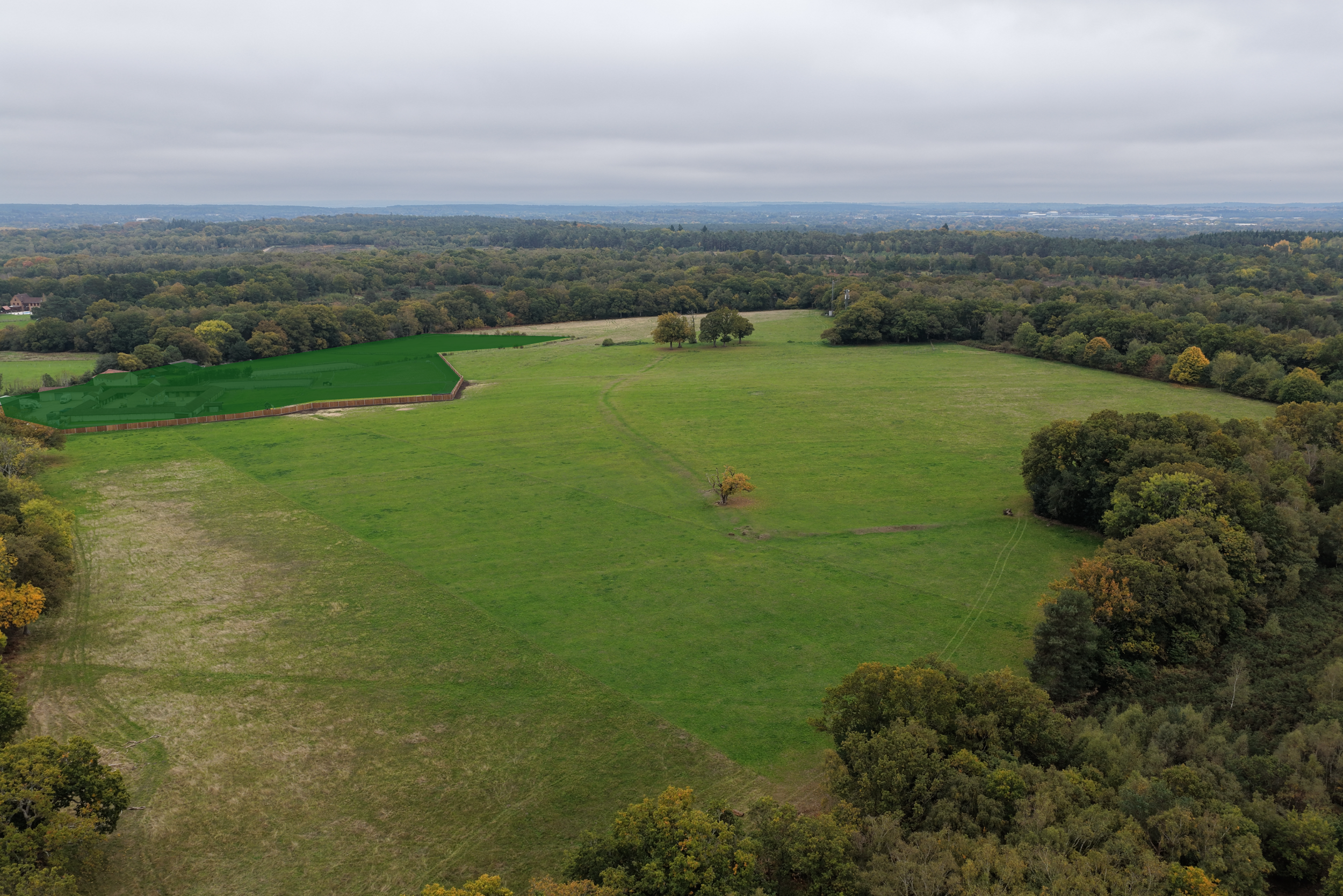
35.3 acres of recreation land in the heart of Yateley Common
Cottage Farm fields were opened to the public in August 2025 as part of a Common Land exchange with Blackbushe Airport. The fields are managed by contractors on behalf of the landowner, Cottage Farm Holding Ltd, and are maintained in accordance with an Environmental Management Plan.
This website will house information relevant to the management of the land in accordance with the conditions of the Environmental Management Plan.
For any issues with the land, please contact admin@cottagefarmyateley.com.
AN ANCIENT FIELD STRUCTURE
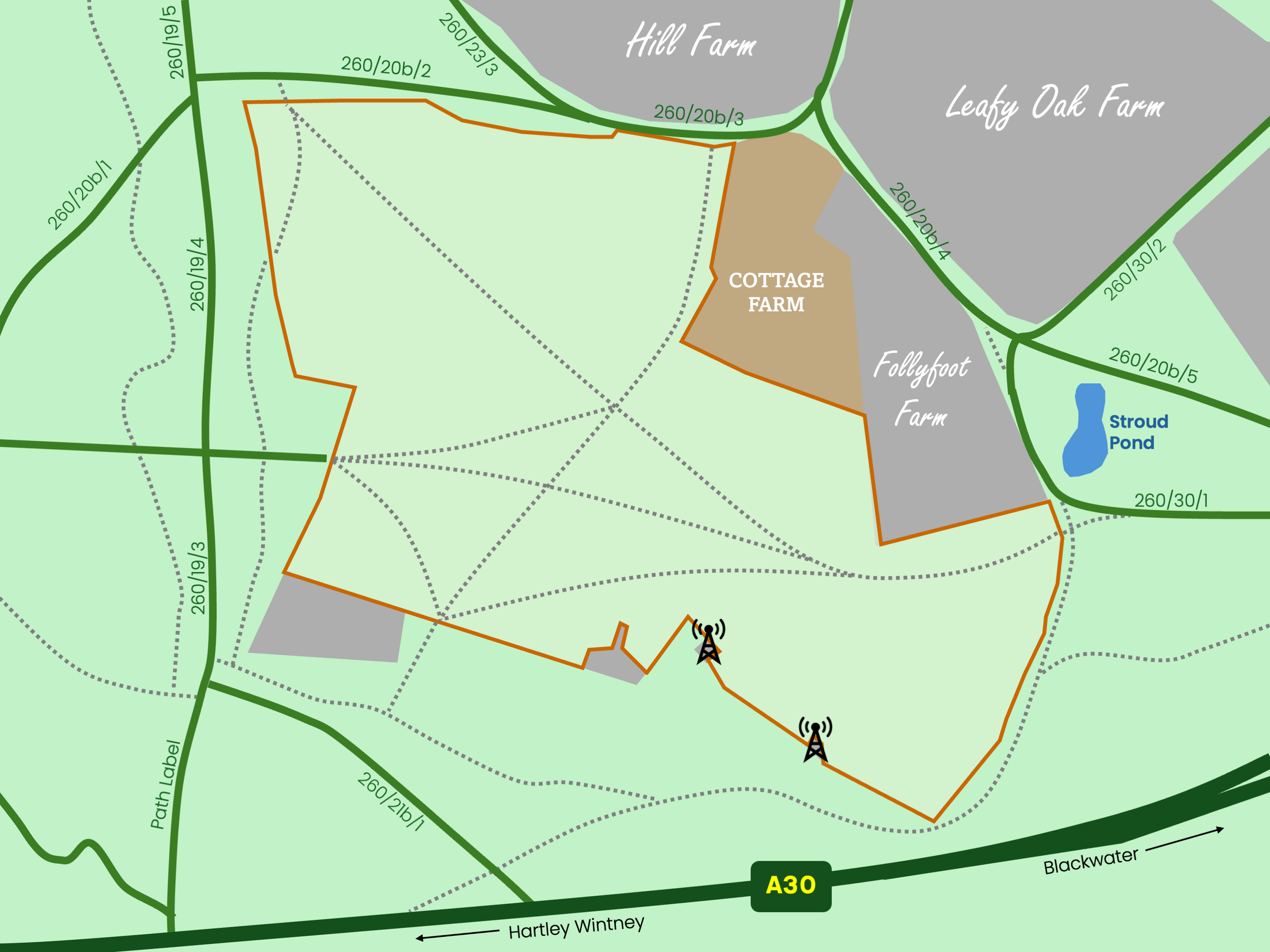
The land at Cottage Farm is ancient, as testified by the large medieval ditch and mounds that surround it, which historically separated it from Yateley Common.
This land was progressively ‘assarted’ (cleared of scrub, shrubs and trees), by hand, out of Ancient Woodland, the remnants of which were described by Issac Taylor in 1759 as ‘Yeatly Wood’.
The assarting of the woodland created a landscape of irregular shaped fields with rounded corners, because it was more efficient to do so. However, it is also possible that the large medieval ditch could have once enclosed the Ancient Woodland.
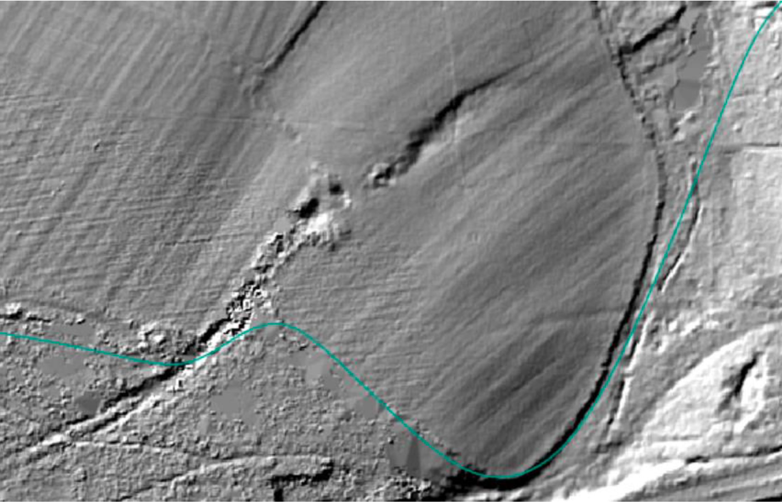
Illustration of ploughing pattern on Cottage Farm fields, courtesy of the HCC Archaeologist
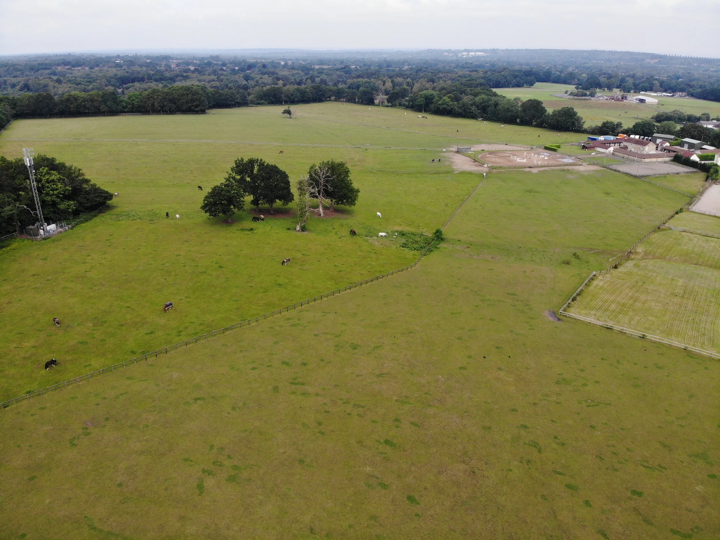
Image from 2021 during Cottage Farm’s period as a livery yard and school.
LOMERS LANE
The linear depression that runs from the middle of the southern boundary, and curves down to the eastern boundary, on which stands a small group of trees, is all that remains of Lomers Lane.
This ran from a loam pit (loam is a soil that is a mixture of clay, sand & silt) in the vicinity of the Old Ely inn, down to Stroude Pool.
Cattle tracks on the Cottage Farm section of Lomers Lane and on the surrounding common show that cattle from the Welsh Drive were driven down Lomers Lane and refreshed at Stroud Pond.
Cattle were kept overnight in the fields and then driven over the common to the annual Blackwater Fair, which was the largest cattle fair in the south of England.
The retention of the lane after the land was assarted, demonstrates the importance of the route in accessing Stroud Pond which is on record as early as 1608. This made Lomers Lane an immoveable feature of the landscape, part of which was still in use as late as the 1960’s.
‘Lomer’ is derived from Middle English, the form of English used in England from roughly the time of the Norman Conquest (1066) until about 1150. It is composed of the prefix lãm for loam and mere for pond, which presumably refers to Stroud Pond, which lies to the east of Cottage Farm.
Thank you to the Yateley Society for providing this historical information.
DOCUMENT LIBRARY
YATELEY COMMON MANAGEMENT COMMITTEE REPORTS
Reports will be available here following YCMC meetings.